Shenzhen's Longgang district made solid progress in developing its low-altitude economy during the first half of the year by strengthening policy support, expanding real-world applications, attracting industry investment and hosting major events.
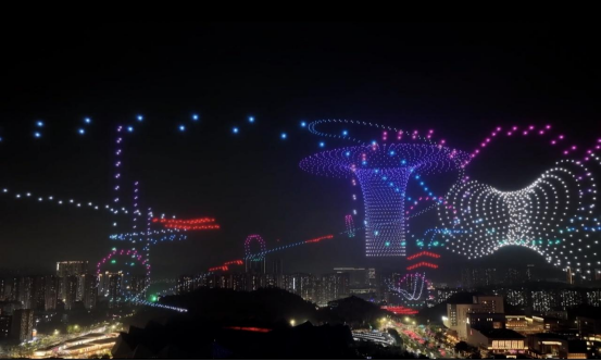
A formation of 4,500 drones creates the world's first dynamic 3D aerial light-and-shadow track that draws massive online attention.
On March 27, the 2026 Longgang Low-Altitude Economy Innovation Development Conference and FPV Drone Racing Challenge was inaugurated, showcasing Longgang's low-altitude applications and brand outreach work in H1.
A centerpiece of the event, the Low-Altitude Economy Innovation Development Conference featured themed exhibitions, technical matchmaking and safety drills. Longgang showcased its technical prowess in formation flight and low-altitude security, facilitated China's first-ever low-altitude public data transaction, and simultaneously released 81 low-altitude industry needs from paired assistance regions spanning seven sectors, including intelligent airspace coordination, emergency rescue, agriculture-tourism integration, low-altitude logistics, and cultural tourism.
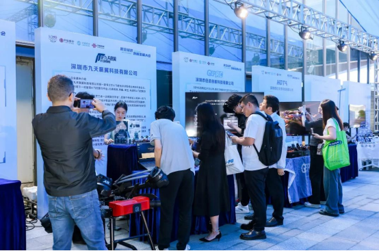
Longgang seals landmark cooperation agreements with Huawei, Cenglin Capital and the Low-Altitude Economy Branch of the IDEA Research Institute, as well as local firms such as Kunxiang Aviation, which secured major national orders.
The Low-Altitude Economy Industrial Investment Fund was unveiled alongside the inauguration of the Low-Altitude Safety Equipment Industrial Consortium. These moves accelerate the creation of a low-altitude ecosystem integrating technology, real-world applications, capital and industrial players, positioning Longgang as a national benchmark demonstration zone for low-altitude industrial ecosystems.
Longgang has broken cross-departmental silos by coordinating flight resources across 28 government agencies. Following the completion of China's first low-altitude public data product transaction, the district established standardized operating procedures and an end-to-end system for collecting, verifying data rights and trading data related to fire prevention, illegal construction, river monitoring and other aspects of urban management.
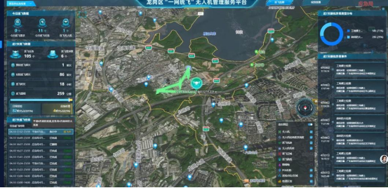
The smart large-screen comprehensive monitoring interface displays Longgang's One-Net Unified Flight UAV management and service platform.
The Aerial Transport Corridor System has rolled out plans for five test routes, prioritizing three core operational tracks: industrial logistics, public services and government administration. Additional applicationsin areas such as emergency supply delivery and cultural tourism shuttle services will be gradually expanded.