Longgang district in Shenzhen has leveraged its Pingdi subdistrict to pioneer a national demonstration zone for low-altitude intelligent networks, aligning closely with China's landmark "Six Networks" infrastructure strategy.
The Political Bureau of the CPC Central Committee and the Executive Meeting of the State Council have identified the Six Networks, which cover water networks, new-type power grids, computing power networks, next-generation communication networks, urban underground pipeline networks and logistics networks, as top infrastructure priorities for the 15th Five-Year Plan (2026-30) period.
Central authorities will advance integrated national computing power networks, satellite internet, and supporting low-altitude facilities. The National Data Administration has also called forstronger digital infrastructure foundations and accelerated pilot low-altitude projects, making Pingdi's pioneering practice a perfect fit for national strategic directions.
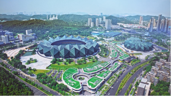
Full-coverage multi-modal sensing supports a China-leading municipal low-altitude supervision platform.
Longgang ranks first among national top 100 industrial districts for eight consecutive years, with its GDP surpassing 600 billion yuan ($88.19 billion). It is also home to over 200 low-altitude economy enterprises.
The Low-Altitude Intelligent Integrated Test Base in Pingdi covers a land area of about 61,000 square meters and controls airspace spanning 12.56 sq m. It stands as South China's first professional drone test site and Shenzhen's optimal carrier for low-altitude flight testing.
Relying on the base, Longgang has rolled out a full suite of new low-altitude infrastructure and forged a replicable, implementable digital governance system for low-altitude airspace.
Longgang has ramped up investment exceeding 40 million yuan in low-altitude infrastructure. The district has deployed at scale 20 sets of 5G-A millimeter-wave integrated communication-sensing macro base stations, four 5G-A air-oriented base stations, 21 Time Difference of Arrival (TDOA) radio detection devices, 11 Remote Identification (RID) recognition units, alongside three optoelectronic cameras and radars to form a full-spectrum multi-modal sensing matrix. Paired with the hardware suite is a dedicated low-altitude safety supervision and service platform.
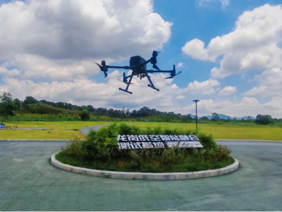
Drones conduct flight tests on-site.
Serving as China's first municipal-level low-altitude management system with all-weather, high-precision continuous tracking capacity, the platform upgrades drone operations from unregulated free flight to fully visible, controllable and pre-warning-enabled flight management. Its core technical indicators outperform the latest national civil aviation industry codes, cementing its industry-leading low-altitude safety governance capacity.
In April, Longgang completed the commissioning of a dedicated air communication private network across the test zone. Multi-layer flight trials have fully verified the network's transmission speed and operational stability. All communication and sensing data generated at the base interconnects in real time with Longgang's 3D digital airspace foundation dubbed Air Gaode Map.
Longgang has pioneered an industry-exclusive Low-Altitude Aerial Intelligent Network (LAIN) architecture integrating communication, sensing, navigation, computing power and meteorology, which is dubbed the Five-in-One Network model. The district has also launched the country's first integrateddigital foundation for low-altitude operations.
The framework enables the large-scale deployment of diverse scenarios including drone logistics, urban aerial inspections and emergency rescue, offering a replicable "Guangdong Solution" for nationwide low-altitude economic development.
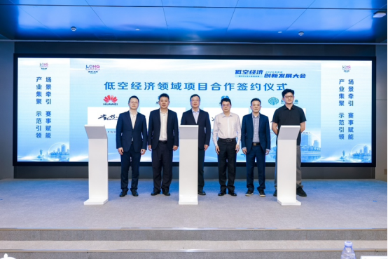
Enterprises sign cooperation deals for low-altitude economy projects.
The Forum on Low-Altitude Intelligent Network Ecosystem and Industry Standard Construction, a supporting event of the 10th World UAV Congress 2026, was hosted in Shenzhen, where external field-testing services for the LAIN system were officially launched. The milestone signals the Pingdi Test Base's entry into a new phase focused on industrial empowerment and open public services.
Longgang now boasts seven industrial parks specializing in low-altitude sectors, 194 drone takeoff and landing platforms, and over 200 regular air routes in operation. It has partnered with Amap to develop the Air Gaode Map 3D airspace visualization system, housed Huawei's drone pilot testing base, and deployed more than 1,700 5G-A base stations across the district.
The district's unified flight supervision platform incorporates 16 AI intelligent algorithms to realize six unified management pillars covering airspace, flight routes, operational missions, flight activities, public services and data governance. Backed by the Smart Integrated Lower Airspace System (SILAS), China's first intelligent integrated low-altitude system, Longgang delivers core technical support for all low-altitude operational activities.
The district's low-altitude industrial output has achieved leapfrog growth, jumping from 1.52 billion yuan in 2023 to 5.42 billion yuan in 2025.
Moving forward, Longgang will uphold its role as a national demonstration hub, continue to refine its low-altitude intelligent network ecosystem and expand its low-altitude industrial clusters. The district will roll out a scalable Longgang Practice to drive the standardized, large-scale development of China's low-altitude economy.